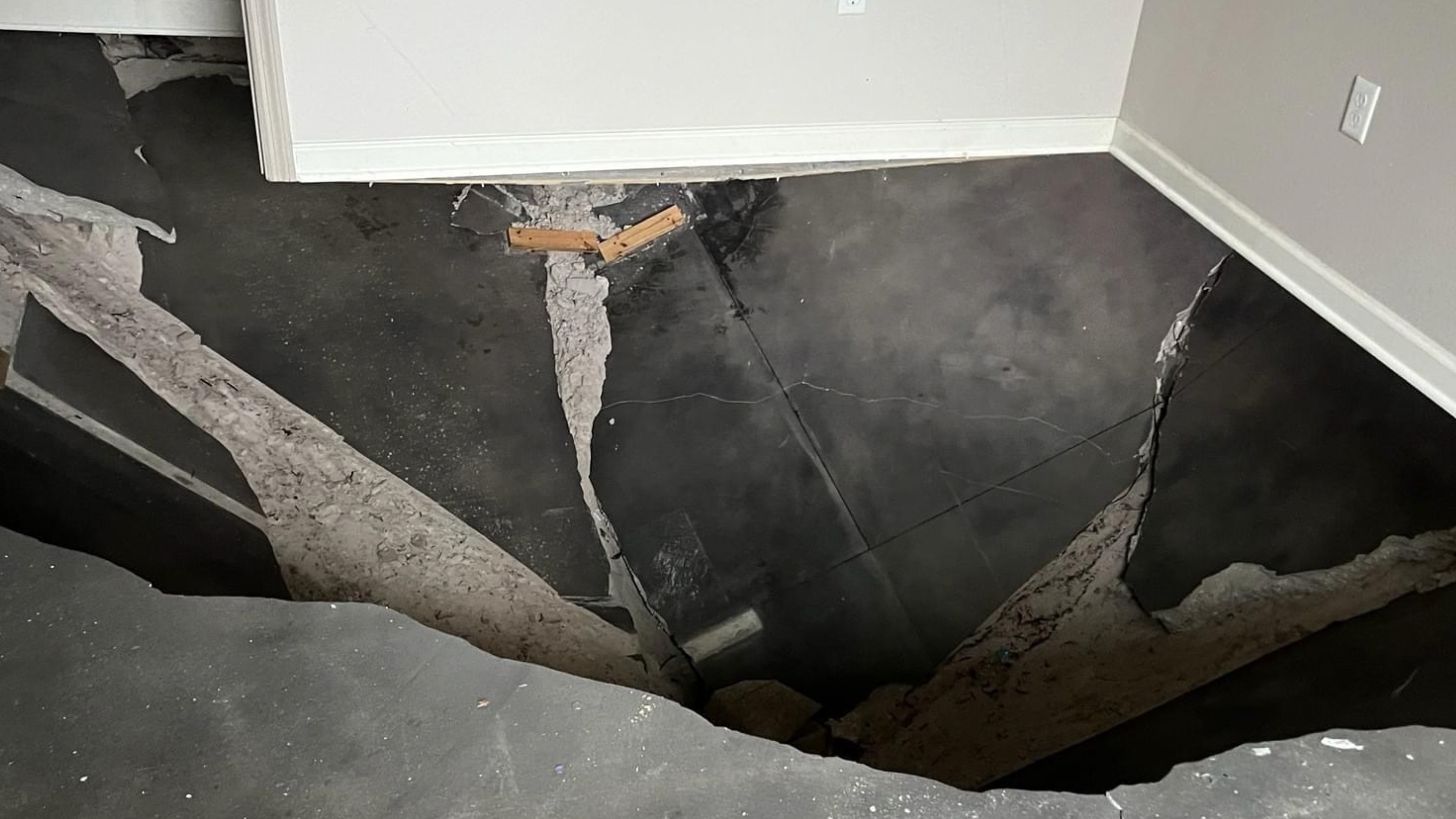
You noticed a shallow dip forming in the backyard after last week’s rain, or a hairline crack that wasn’t there last spring. In Land O’ Lakes, small changes like these carry more weight than they would almost anywhere else in the country.
Pasco County sits over some of Florida’s most active limestone terrain. Sandy soils, heavy summer rain, and a water table that rises and falls with the seasons interact here in ways that can quietly loosen the ground beneath a house.
Helicon has worked these soils since 2004, with a 4.9-star reputation among local homeowners and two decades of experience in Florida’s sinkhole-prone geology. That matters here because a Land O’ Lakes property can behave differently from one a few miles away, and because the honest answer to “is this crack serious” depends on what the ground is doing rather than on what the crack looks like.
This guide covers how to read the warning signs on your own property, how to separate ordinary settling from possible sinkhole activity, and how to use local history and county records without either panicking or dismissing what you’re seeing.
Why Local Ground Conditions Need Attention
If your yard stays soggy long after a storm, or a patch of lawn sinks a little more each year, the ground may be telling you something. This part of Central Florida sits in what is often called sinkhole alley, a band running north from Tampa where limestone and dolomite bedrock lie unusually close to the surface.
Slightly acidic rainwater dissolves that rock over time. As the Florida Geological Survey explains, most rainwater is mildly acidic and becomes more so as it moves through decaying plant material, then percolates through porous limestone and carries dissolved rock away. Over very long spans, that process creates underground voids, and sinkholes form when the sediment above those voids collapses into them.
Karst Limestone and Sandy Soils in Pasco County
Beneath Pasco County, porous limestone sits under loose sandy soil. As the rock dissolves, cavities form, and the sandy layer above has little cohesion to bridge a gap once support disappears below it.
How Groundwater, Rainfall, and the Water Table Affect Support
Groundwater here rises and falls seasonally. Each swing loads and unloads the soil above the limestone, and heavy rain pushes more acidic water through the rock. Sharp drops in water level are particularly relevant, since water partly holds the overburden up.
Why Development and Irrigation Change Drainage Patterns
New construction and irrigation change how water crosses a yard. Heavier watering, altered grading, or a new drainage pipe can concentrate water in one spot that never received it before, shifting the balance underground.
Warning Signs to Watch Around Your Property
A door that suddenly sticks, a new crack along the garage wall, or a soft spot in the grass near the patio are the details homeowners here learn to take seriously. None of them proves a sinkhole is forming. All of them deserve a closer look sooner rather than later, and they matter most in combination, since one sign alone rarely tells the story.
Yard depressions, soft ground, and new drainage changes. A circular low spot, a section that stays muddy after the rest of the yard drains, or water pooling somewhere new all suggest soil is settling below the surface.
Cracks in driveways, slabs, and foundation areas. Watch for cracks that widen over a few weeks, particularly diagonal or stair-step patterns in block walls, which indicate one side of the structure is settling faster than the other.
Sticking doors and windows, sloping floors, and gaps at trim. A door that closed easily last month and now needs force, or a floor that feels tilted, usually means the foundation under that area has lost even support.
Mark the ends of any crack with a pencil and date it. Stake the edges of a depression. Whether either one moves over the next few weeks is the most useful information you can hand an engineer.
How to Tell Settlement From Possible Sinkhole Activity
Separating routine wear from something serious is the hardest part, and Florida’s sandy soils shift with moisture on their own. Older homes settle over decades with no sinkhole involved.
Why Surface Damage Does Not Confirm an Underground Void
A crack or depression tells you something changed at the surface. Confirming a void requires testing below ground, which is why engineers use instruments rather than eyes.
Other Causes That Mimic a Sinkhole
The Florida Geological Survey lists several non-sinkhole causes of depressions and subsidence: broken sewer or drain pipes, failed septic tanks, soil that was never properly compacted after excavation, organic layers that compress as water leaves them, and buried trash, logs, or stumps that decompose over years.
A depression that hasn’t been verified by a licensed geologist or engineer is formally a subsidence incident, not a sinkhole.
What a Professional Ground Assessment Can Verify
Engineers use ground-penetrating radar and soil borings to check for voids beneath a specific lot. Only that kind of testing can establish whether a real risk exists on your property.
Worth knowing before you make calls: the Florida Department of Environmental Protection does not inspect suspected sinkholes. It runs the FGS Sinkhole Helpline at 850-245-2118 to answer questions and publishes a homeowner’s guide, but it directs anyone needing an actual assessment to a certified home inspector or foundation specialist.
Using Local History and County Records Without Assuming the Worst
A sinkhole a mile away doesn’t mean your yard shares its risk, though it’s natural to wonder. Land O’ Lakes has documented history worth understanding, along with real limits on what that history says about one parcel.
What the Lake Padgett Estates Event Actually Showed
On the morning of July 14, 2017, a depression opened behind a home at 21825 Ocean Pines Drive in Lake Padgett Estates. Fire crews arrived to something described as roughly the size of a small pool. Within minutes, it swallowed a boat, and it went on to destroy the homes at 21825 and 21835 Ocean Pines Drive.
It kept growing. By early August, the hole measured about 260 feet at its widest and roughly 50 feet deep, the largest on record in Pasco County, and the county condemned seven homes in total.
The part most coverage leaves out is what happened next. Four nearby families disputed their condemnations, hired their own engineers to evaluate their properties, and won the right to move back in after signing indemnification releases. Geophysical testing with ground-penetrating radar found stable conditions under those specific homes despite their proximity to the collapse.
That is the practical lesson of Lake Padgett Estates. Proximity to a documented sinkhole is not the same as risk to a particular parcel, and the only thing that settled the question for those families was property-specific engineering.
How to Check Records for Your Own Address
The Pasco County Property Appraiser publishes subsidence and sinkhole information as a map layer, with instructions for viewing sinkhole properties on its parcel mapping site. You can zoom to your neighborhood, switch on the subsidence layer, and see which parcels carry a record. These reflect documented events rather than neighborhood rumor, which makes them far more reliable than secondhand accounts.
Limits of Any Sinkhole Map
A map shows historical points. It often won’t tell you the date, the size, the cause, or the current status of each one. A single pin can mean a small dip remediated fifteen years ago or an open question.
Treat a map as a source of questions to ask, not an answer, and remember that an absent pin proves nothing either, since the statewide subsidence database is built largely from voluntary reports that were never field verified.
Take a Measured Next Step When the Ground Changes
If you’ve found a new crack, a sunken patch of yard, or a door that won’t latch, the right response is methodical rather than dramatic. Sinkhole activity here rarely arrives without warning, and acting early keeps both cost and stress down.
When to Keep People Away From a Suspected Hazard
If a depression looks new or is visibly growing, keep people, pets, and vehicles away and avoid adding weight nearby. If there is any risk of physical harm, call local law enforcement first. Stake the edges so you can track whether it is expanding while you wait for a professional.
How Grouting and Soil Stabilization Address Confirmed Voids
Once testing confirms a void, compaction grouting fills the space and densifies the loose soil around it, restoring support without full excavation. Depending on what the assessment finds, the work may also involve soil stabilization, sinkhole repair, or foundation repair where the structure itself has moved.
Helicon has performed this work across the Tampa Bay region since 2004, and its Tampa office covers Land O’ Lakes and the surrounding Pasco communities.
Frequently Asked Questions
Where was the Land O’ Lakes sinkhole?
The best-known event opened on July 14, 2017, behind a home at 21825 Ocean Pines Drive in the Lake Padgett Estates neighborhood. It destroyed two homes and eventually reached about 260 feet across and 50 feet deep, the largest recorded in Pasco County.
Are there active sinkholes in Land O’ Lakes today?
Subsidence is reported in Pasco County most years, but a reported depression is not a confirmed sinkhole until a licensed geologist or engineer verifies it. Confirmed activity appears in county property records; a professional assessment is what establishes status on a given lot.
What happened at the sinkhole near Lake Padgett Estates?
It opened as a small depression under a parked boat, swallowed the boat within minutes, and destroyed the homes at 21825 and 21835 Ocean Pines Drive. Pasco County condemned seven homes as it expanded. Four of those condemnations were later reversed after the owners commissioned their own engineering evaluations.
Is 21835 Ocean Pines Drive affected by a sinkhole?
The home at that address was one of the two destroyed when the sinkhole opened in July 2017. For the current status of that or any nearby parcel, the Pasco County Property Appraiser’s subsidence map layer is the authoritative source, since records are updated as new information arrives.
Does homeowners insurance cover sinkhole damage in Florida?
Florida policies are required to cover catastrophic ground cover collapse, which is a narrowly defined event requiring specific conditions including structural damage and condemnation. Broader sinkhole loss coverage is generally a separate endorsement you have to buy. Check your own policy language, and document what you observe with dated photos.
Does a sinkhole near my house mean my property is at risk?
Not necessarily, and Lake Padgett Estates is the clearest illustration. Homes immediately beside a 260-foot collapse were found to have stable ground beneath them once engineers tested. Distance is a reason to ask the question, not an answer to it.
How do homeowners spot sinkhole warning signs in Land O’ Lakes?
Look for new cracks in walls or slabs, doors and windows that suddenly stick, sloping floors, and circular depressions or unusually soft ground in the yard. Two or more appearing together, or any one of them worsening over a few weeks, is reason enough to request a ground assessment.
Reading the Ground Before It Reads You
Cracks, sticking doors, and soft spots rarely mean an emergency. In Land O’ Lakes, they are worth taking seriously rather than explaining away, because Pasco County’s limestone geology means small surface changes can reflect larger shifts out of sight.
The history around Ocean Pines Drive cuts both ways. It shows how quickly conditions can change, and it shows that homes beside a major collapse were cleared once someone actually tested the ground under them. Either way, the answer came from engineering rather than guesswork.
Helicon offers a free, no-obligation inspection for Land O’ Lakes homeowners who want a documented answer about what is happening beneath their property, while the signs are still small enough to be manageable.