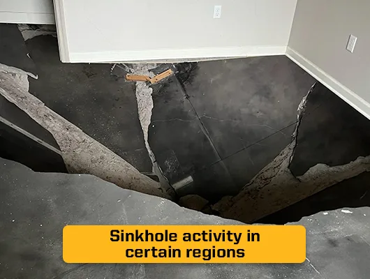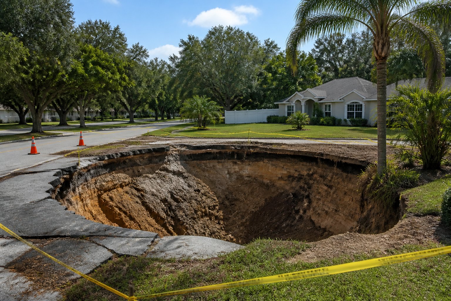
You are looking at a listing in West-Central Florida, and somewhere in your research the term “Sinkhole Alley” keeps coming up. Maybe a real estate agent mentioned it in passing, or you noticed a neighbor’s yard with an odd depression while touring the area. Before you make an offer, you want to know what that phrase actually means for the ground under a specific house.
Helicon has spent years working on Florida foundations and soil conditions, watching how limestone geology under counties like Pasco and Hernando shapes real property outcomes.
This guide explains which counties make up Sinkhole Alley, why the region reports more sinkhole activity than other parts of the state, and what a smart buyer should check before closing.
Which Counties Form the Core of Sinkhole Alley?
Sinkhole Alley refers to a specific cluster of counties in West-Central Florida where reported sinkhole activity and insurance claims run far higher than the state average. Most industry and geological sources place the core in three neighboring counties north and east of Tampa.
Pasco, Hernando, and Hillsborough Counties
Pasco, Hernando, and Hillsborough counties form the heart of Sinkhole Alley. These three counties accounted for over 66 percent of Florida’s sinkhole insurance claims between 2006 and 2009, according to a Florida Senate interim report on sinkhole insurance.
That concentration is not a reporting coincidence. It lines up with a band of geology where the limestone bedrock sits close to the surface, and the layer meant to protect it has thinned out over time.
Hillsborough County includes the Tampa Bay area itself, where dense development sits directly over this vulnerable geology. Pasco County has drawn particular attention for its frequency of new sinkhole events, including several high-profile collapses that made statewide news. Hernando County, just north of Pasco, shares nearly identical bedrock conditions and a similar claims history.
Why Some Definitions Also Include Pinellas and Polk
Some industry sources widen the definition of Sinkhole Alley to include Pinellas and Polk counties alongside the core three. Pinellas sits along the coast west of Hillsborough, while Polk lies to the east and is sometimes called the state’s phosphate belt because of its mineral history.
Both counties share enough of the same karst limestone conditions to report meaningfully elevated sinkhole activity, even if their totals fall below Pasco, Hernando, and Hillsborough.
This wider definition matters if you are house hunting anywhere in the Tampa-to-Lakeland corridor. A property in Polk County sits under different local conditions than one in Pasco, but the underlying limestone story is closely related. Knowing where your target county falls on this spectrum is only the first step, because sinkhole reports do not stop at the Sinkhole Alley border.
Where Else Do Florida Sinkholes Occur?
Florida sinkholes are not confined to five counties near Tampa. The entire state sits on carbonate bedrock, so reported activity shows up from the Panhandle to Central Florida, just less densely than in the core region.
Counties North of the Core
Citrus, Sumter, and Marion counties north of Hernando share closely related geology and also see notable sinkhole reporting. Some regional discussions describe an extended alley running from Hernando and Hillsborough up through Central Florida, where cracked limestone sitting a relatively short distance below the surface is capped by a thin layer of sand or sand-clay soil.
Lake County and Alachua County, home to Gainesville, also report regular sinkhole activity tied to the same Ocala Limestone formation that underlies much of North-Central Florida.
Alachua County is notable for Devil’s Millhopper, a large collapsed sinkhole now preserved as a state park near Gainesville, showing how long these features have existed. Jackson, Jefferson, Columbia, Hamilton, Gilchrist, and Lafayette counties, scattered across North Florida, also carry documented subsidence reports, since karst terrain runs through much of that part of the state as well.
Other Inland Counties and the Winter Park Example
Orange County’s Winter Park produced one of Florida’s most famous sinkholes in 1981, when a collapse roughly 350 feet wide swallowed a house, several cars, and part of a street, eventually becoming what locals call Lake Rose. That event shows sinkhole activity is not limited to the counties most commonly named in Sinkhole Alley discussions. Highlands County, in the state’s interior lakes region, also reports periodic activity tied to its own limestone conditions.
Coastal and southern counties tell a different story. Broward, Charlotte, Clay, Collier, Duval, and Lee counties report far fewer sinkholes, largely because the limestone sits deeper below the surface or is separated from groundwater by thicker confining layers.
Why Reports From Other Counties Need Context
A single sinkhole report in a county outside the core does not mean that county carries the same risk level as Pasco or Hernando. The frequency, not just the presence, of sinkhole activity is what defines Sinkhole Alley. A county with one or two historical reports over decades sits in a very different risk category than one with hundreds of confirmed events.
This distinction becomes clearer once you understand the geology driving the difference between counties, which is the real question behind every map you will look at.
Why Does West-Central Florida Report More Sinkhole Activity?
West-Central Florida reports more sinkhole activity because of a specific combination of limestone depth, groundwater behavior, and a thinning protective soil layer. This is not random bad luck. It is a predictable result of geology.
How Limestone, Dolomite, and Groundwater Create Voids
Florida sits on a thick platform of limestone and dolomite that formed under ancient seas. Rainwater absorbs carbon dioxide as it falls, becomes slightly acidic, and slowly dissolves the carbonate rock as it moves underground. Over long periods, this process, known as karst dissolution, carves out caverns and voids beneath the surface.
In Sinkhole Alley, a confining layer called the Hawthorn Group, made up of clays, sands, and phosphate minerals, normally sits atop the limestone and slows this dissolution. Across Pasco, Hernando, and Hillsborough counties, this layer is thin, patchy, or absent in many places, exposing more limestone to groundwater movement.
Large groundwater withdrawals can trigger sinkhole formation, since abrupt declines in water levels reduce the buoyant support that helps hold up the soil bridging a void, according to a U.S. Geological Survey study of sinkhole types and occurrence in west-central Florida.
How Soil Cover, Drainage, and Development Affect Surface Conditions
The soil type above the limestone determines how a void expresses itself at the surface. Where clay-rich soil bridges a growing cavity, the ground can hold for years before collapsing suddenly, a pattern known as cover-collapse. Where the soil is sandy and permeable, it settles gradually into the void instead, creating a slow, bowl-shaped depression called cover-subsidence.
Development changes this equation further. Diverted stormwater, added building weight, and altered drainage patterns can accelerate the process in areas already prone to it. Tropical storm rainfall adds another layer of risk, since intense, sudden rain events can rapidly change groundwater pressure, a pattern consistent with how storm cycles interact with karst terrain in west-central Florida.
Why Insurance Claims and Incident Reports Measure Different Things
Insurance claim data and subsidence incident reports measure different things, and mixing them up creates confusion. Claims data reflects confirmed, insured losses tied to sinkhole activity, while incident reports capture every reported ground depression, verified or not. Both point toward the same core counties, but neither one gives you a complete picture on its own.
That gap between what gets reported and what gets confirmed is exactly why the next question (what a sinkhole map can and cannot tell you) deserves its own close look.
What Can a Sinkhole Map Tell You About a County?
A sinkhole map shows you where subsidence has been reported historically, not where a future sinkhole will form. Reading one correctly means understanding what the data actually represents.
Where to Find Florida’s Reported Subsidence Incidents
The Florida Geological Survey’s subsidence incident database, accessible through the state’s Map Direct tool, is the primary public source for reported ground depressions statewide.
Reports come from citizens, county and state dispatchers through the State Watch Office, and the Florida Department of Transportation, all submitted voluntarily. There has never been a legal requirement to log a sinkhole occurrence or claim in this database, so it reflects what people chose to report, not a full accounting of every event.
You can search this map by address or general area to see what has been logged near a property you are considering. It is a genuinely useful starting point, especially paired with our own Florida sinkhole map resource for a clearer regional view.
Why a Reported Depression Is Not Always a Confirmed Sinkhole
Most entries in the subsidence database have never been field-verified by a licensed geologist. A reported depression could be a true sinkhole, or it could stem from a broken septic tank, a decomposing tree stump, poorly compacted fill soil after construction, or a collapsed drain pipe, according to the Florida Department of Environmental Protection. Treating every dot on the map as a confirmed sinkhole overstates the risk in some spots and understates it in others.
- A “confirmed” sinkhole has been field-checked by a licensed professional geologist.
- An “unverified” or “subsidence incident” report has not been checked, and the cause is unknown.
- A cluster of unverified reports in one area still suggests a pattern worth investigating further.
- A single unverified report far from other activity carries much less weight.
Why County Patterns Cannot Predict Conditions on a Lot
County-level data describes a region’s tendencies, not a specific parcel’s condition. Two houses a quarter mile apart can sit on meaningfully different soil and bedrock conditions. That’s why relying on a county name or a map dot alone leaves a real gap in your due diligence before buying anything.
What Should You Check Before Buying a Property?
Checking a property before you buy means going beyond the county’s reputation and looking at the site’s own history, soil, and insurance situation. Three areas deserve direct attention.
Review Site History and Ask About Past Ground Movement
Florida law requires sellers to disclose known sinkhole activity or prior repairs on a property. Ask directly whether the seller has filed a sinkhole insurance claim, commissioned an engineering report, or repaired any past ground movement. Request copies of any past geotechnical or structural reports tied to the property, since these documents describe exactly what a licensed engineer found underground.
Consider Soil, Drainage, and a Property-Specific Evaluation
Sandy fill soils behave differently than clay-heavy soils when a void opens beneath them, so knowing what sits under a specific lot matters more than knowing the county average.
A property-specific evaluation, sometimes involving ground-penetrating radar or soil borings, gives you direct evidence about what lies beneath a lot rather than an inference drawn from a county-wide pattern. Watch for visible warning signs during a walkthrough too:
- Cracks in walls or the foundation, especially diagonal cracks near doors and windows
- Doors or windows that suddenly stick or will not close properly
- Depressions, soft spots, or bowl-shaped low areas in the yard
- Cracks appearing in a driveway, pool deck, or walkway
If you notice any of these during a showing, our foundation inspection guide explains what a professional visit typically involves, and our sinkhole repair page outlines how confirmed voids and cavities get addressed.
Check What Your Insurance Policy Actually Covers
Florida law requires every homeowner policy to include catastrophic ground cover collapse coverage, but this applies only to sudden, dramatic collapse that condemns the structure.
Broader sinkhole loss coverage, which addresses gradual settling and cosmetic cracking, is an optional endorsement you have to add separately and review carefully before closing.
Understanding these three checks turns a county-level headline into a concrete, property-specific picture, which is really the entire point of doing this kind of homework before you sign anything.
Use County Patterns as a Starting Point, Not a Property Verdict
County data tells you where to look closer, not what you will find. Sinkhole Alley is a genuinely useful shorthand for understanding regional geology, but it was never meant to function as a property-level verdict.
A house in Pasco County is not automatically compromised, and a house in Broward County is not automatically safe. Karst limestone runs under the entire state to varying depths, and local soil conditions, past land use, and drainage history all shape what is actually happening beneath a specific lot. Treating a county label as a final answer skips the step that actually protects your purchase.
The right approach combines public data, seller disclosure, and a direct, professional look at the ground itself. Each piece fills a gap the others cannot cover on their own, and together they give you a realistic picture instead of a map-based guess.
That combination of research and direct inspection is exactly what turns county-level curiosity into a confident buying decision, which brings us to the most common questions buyers ask along the way.
Frequently Asked Questions
Where is Sinkhole Alley in Florida?
Sinkhole Alley sits in West-Central Florida, centered on Pasco, Hernando, and Hillsborough counties around the Tampa Bay area. Some definitions extend the region to include Pinellas and Polk counties, since they share similar limestone geology and elevated sinkhole reporting.
Which Florida counties report the most sinkhole activity?
Pasco, Hernando, and Hillsborough counties report the highest concentration of confirmed sinkholes and insurance claims in the state. Citrus, Sumter, Marion, and Polk counties also report notable activity tied to related limestone geology just outside the core three.
Does buying outside Sinkhole Alley mean a property is safe from sinkholes?
No single county guarantees safety, since carbonate bedrock underlies most of Florida to some degree. Counties like Broward, Palm Beach, and Miami-Dade report far fewer sinkholes because the limestone sits deeper below the surface, but isolated events can still happen anywhere.
Can a Florida sinkhole map show whether a specific lot has a sinkhole?
A sinkhole map shows historical reported activity in an area, not a guaranteed condition on any single parcel. Most entries in Florida’s subsidence database have never been field-verified, so a property-specific inspection is the only way to get a direct answer for one lot.
Does homeowners insurance cover sinkhole damage in Florida?
Standard policies must include catastrophic ground cover collapse coverage, which applies only to sudden, severe collapse that condemns the structure. Broader sinkhole loss coverage for gradual settling and cracking is optional and typically requires a separate endorsement with its own deductible.
If your concrete is sinking or cracked, a free inspection from Helicon will tell you exactly what is happening beneath the surface and what it takes to fix it permanently.